
By Antoine Lemaire
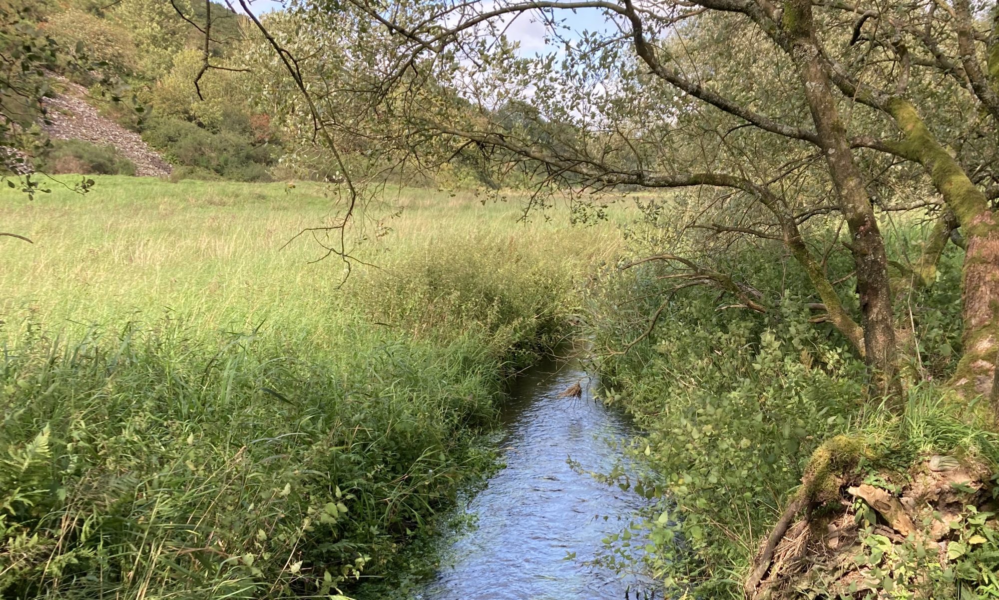
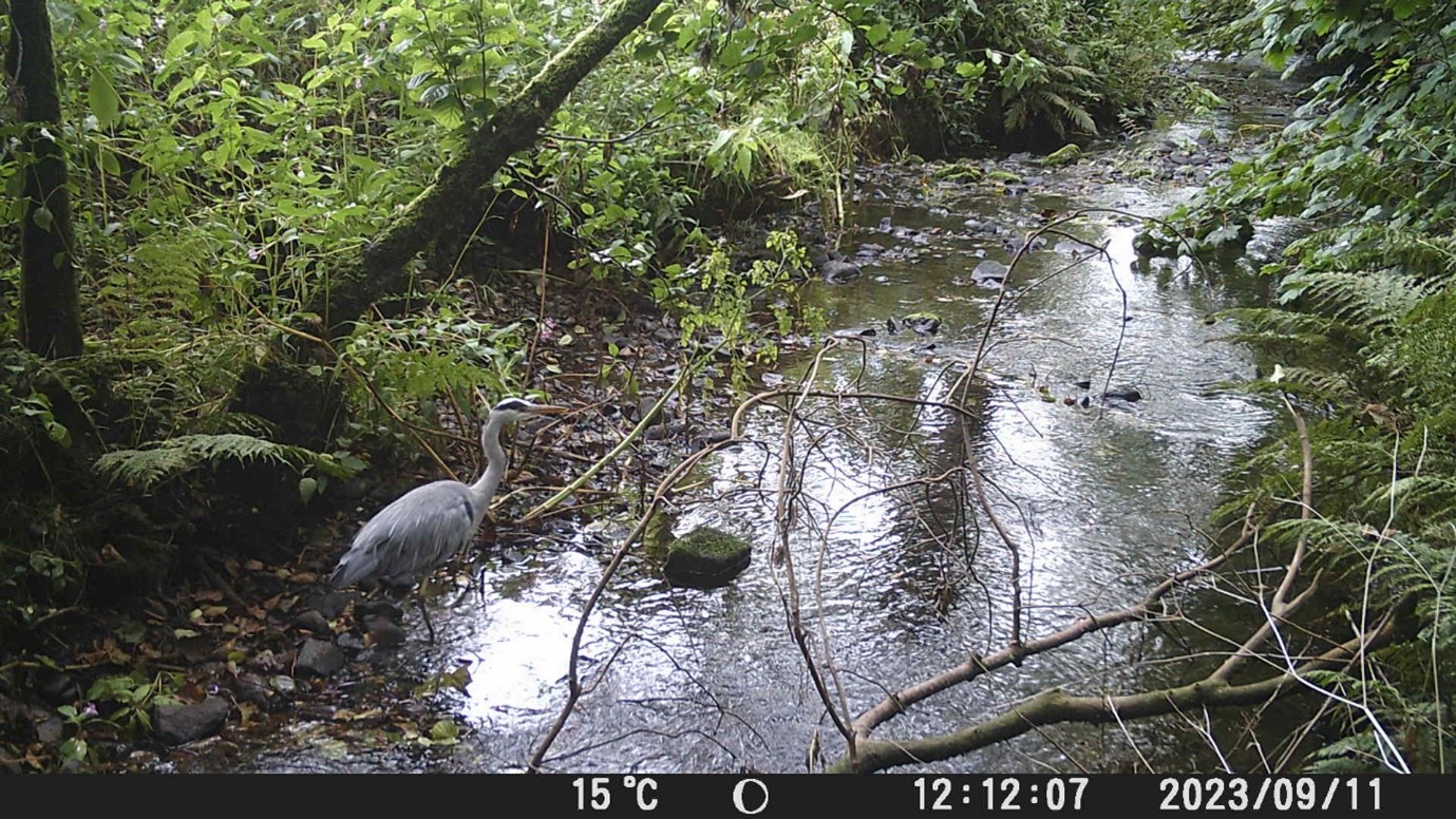
As part of surveying the Glenmidge Burn and adjacent land, four trail cameras have been set up in various places. Three of them were lent to us by the South West Scotland Environmental Information Centre. It has been great to read the land and the whispers of trails in order to make sure the cameras would catch glimpses of wildlife along the burn.
Lots of trial and error, but we got some fun footage in the end. The changing water levels however, have also given us some grief. At the foot of the burn, by the Nith, although it was set about 6 feet above the water, the camera came close to being submerged in September. Another camera set in a low-lying area was not so lucky. When I arrived to retrieve the data, the area was unrecognisable. Where there was nothing but trees and crunchy dead leaves in the summer, there was now only water. I had to wade in, it was very cold, and it just kept getting deeper. By the time I got to the first trees, the water was up to my chin! I was struggling to recognise which submerged tree I had fixed the camera to, but I eventually found it 3 feet under the surface. Luckily it was a balmy day and I warmed up quickly once I was out!

These pictures were taken ten days apart! Look at how high the water is.
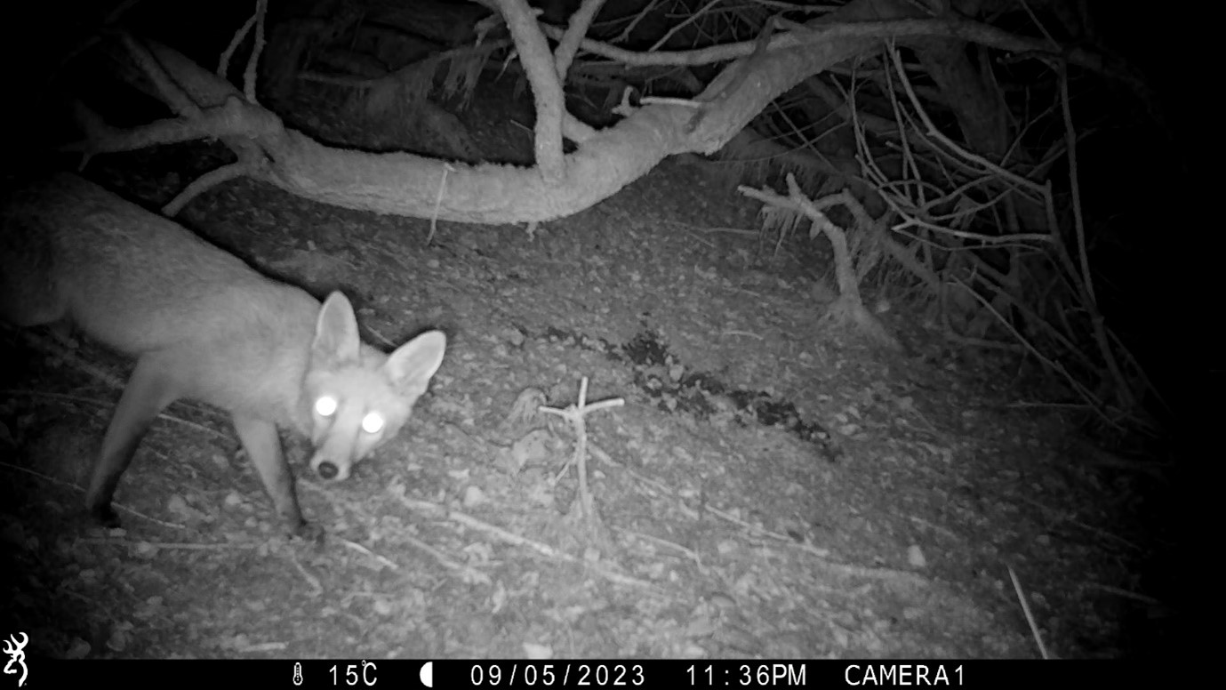
Foxes seem to be aware of the camera – possibly the sound of the mechanism when it is triggered.
You can check some footage on our Youtube channel.
